Bandrow and Region Maps
Bandrow Regional Map
In 2015 Galizen German Descendants group embarked on a project. We funded a researcher in Poland who visited the Archives and extracted information on German villages that have NOT been microfilmed by the Family History Library (FHL). Many of the later records of our Galizien German Descendants are not available through the FHL and these were our target records. These maps are part of the first fruit of these researches.
The following maps of the Bandrow area have been created for GGD
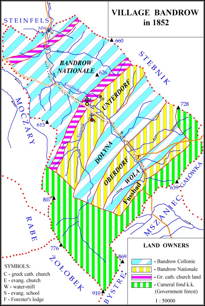
(listed from north to south) ( The Symbols used in the maps below are given here )
- Steinfels in 1852
- Steinfels in 1900
- Steinfels in 1939 (Includes list of residents, occupation and ethnicity)
- Bandrow Unterdorf in 1788
- Bandrow Lower village (Unterdorf) in 1937 (constructed by E. Ackerman and S. Mack in 1998)
- Bandrow-Dolyna West in 1885
- Bandrow-Dolyna East in 1885
- Bandrow Oberdorf in 1852
- Bandrow Upper village (Oberdorf) in 1937 (constructed by E. Ackerman and S. Mack in 1998)